Customize Consent Preferences

We use cookies to help you navigate efficiently and perform certain functions. You will find detailed information about all cookies under each consent category below.

The cookies that are categorized as "Necessary" are stored on your browser as they are essential for enabling the basic functionalities of the site. ... 

Always Active

Necessary cookies are required to enable the basic features of this site, such as providing secure log-in or adjusting your consent preferences. These cookies do not store any personally identifiable data.

Functional cookies help perform certain functionalities like sharing the content of the website on social media platforms, collecting feedback, and other third-party features.

Analytical cookies are used to understand how visitors interact with the website. These cookies help provide information on metrics such as the number of visitors, bounce rate, traffic source, etc.

Performance cookies are used to understand and analyze the key performance indexes of the website which helps in delivering a better user experience for the visitors.

Advertisement cookies are used to provide visitors with customized advertisements based on the pages you visited previously and to analyze the effectiveness of the ad campaigns.

Nevihtno dogajanje med 13 in 14. 8. 2024

Avtor reportaže: Matej Štegar

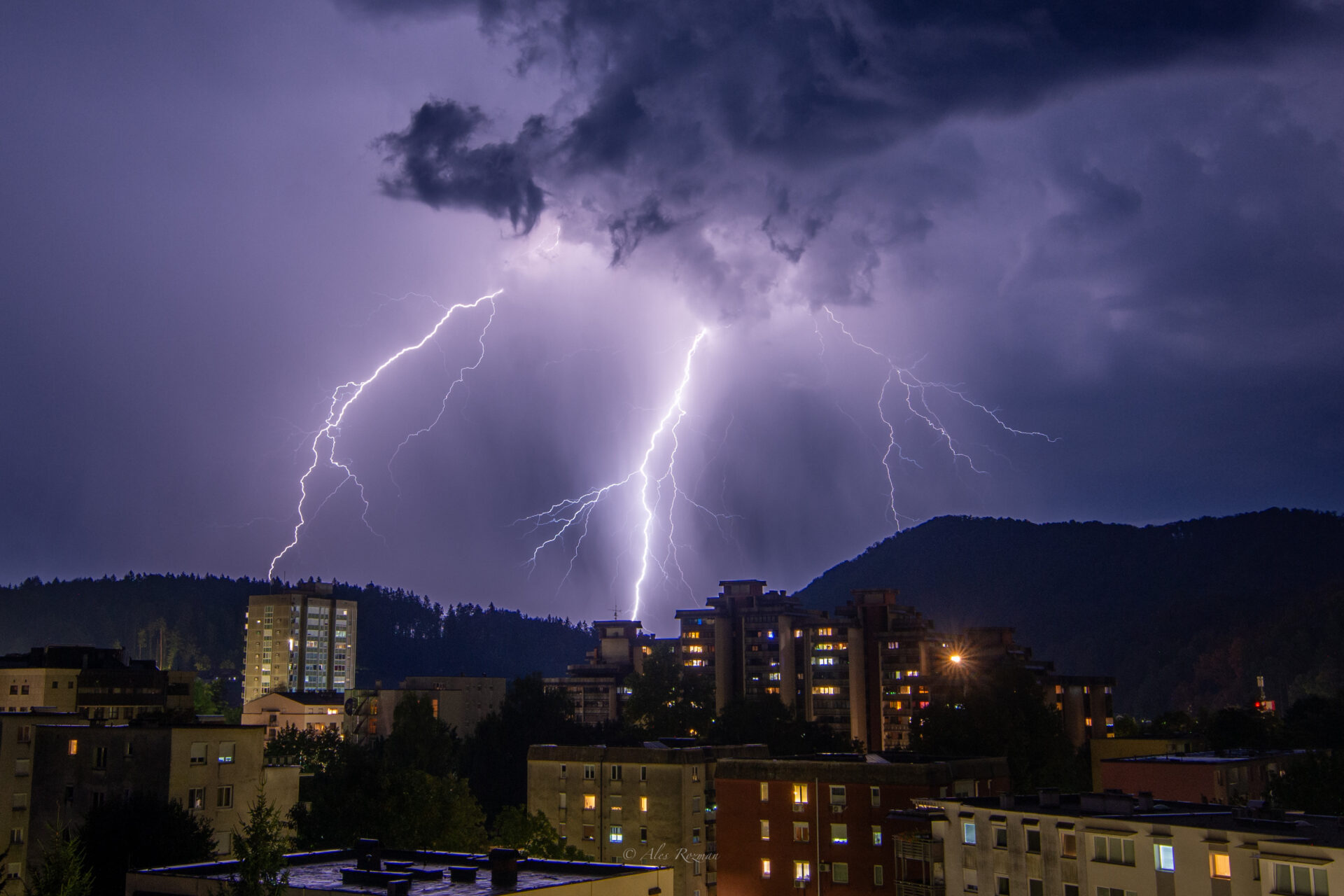
Manjši nevihtni sistem se je v torek zvečer pomikal nad Koroško in Štajersko. Nevihto so spremljali krajevni nalivi, sunki vetra, in številni udari strel.

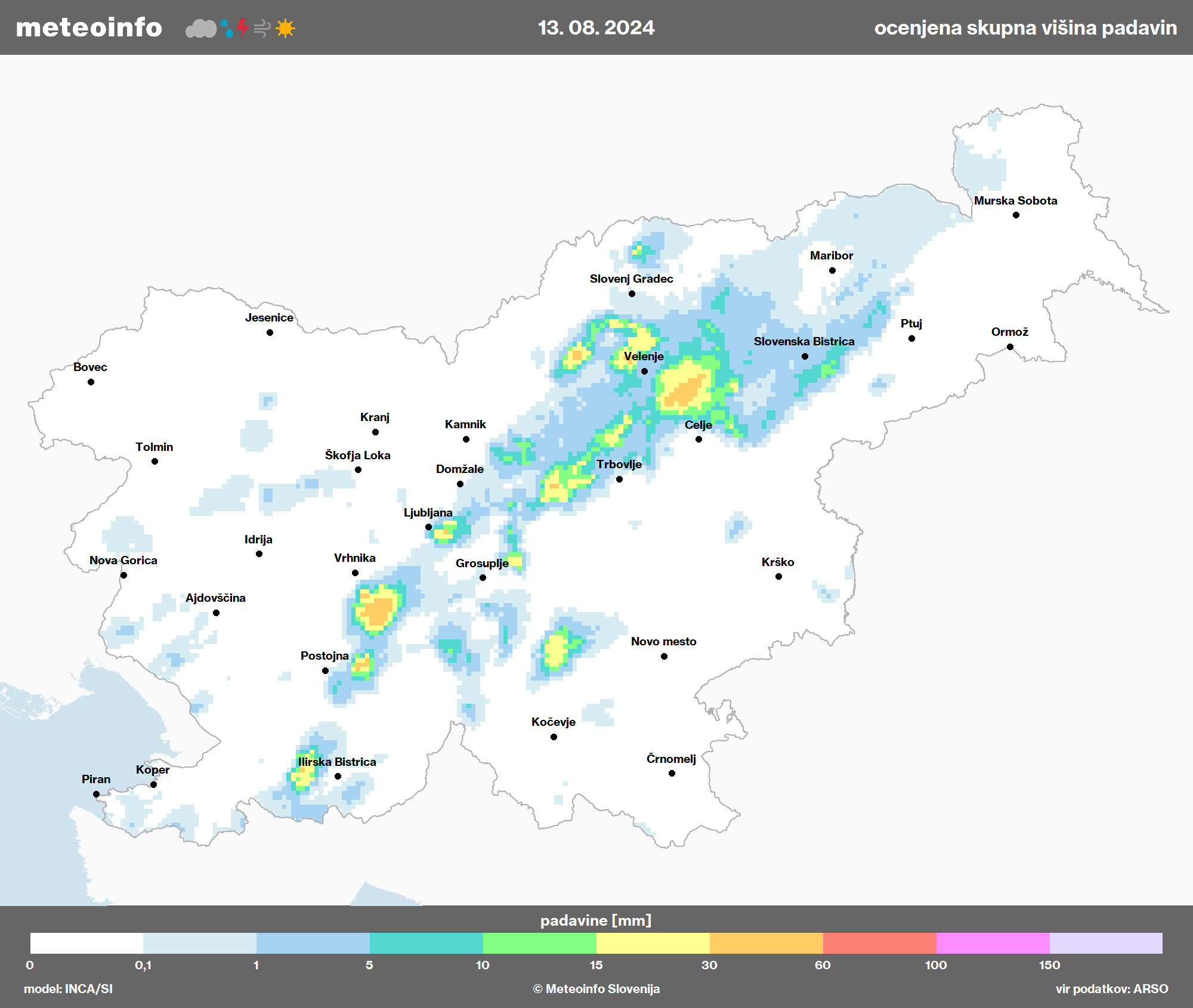
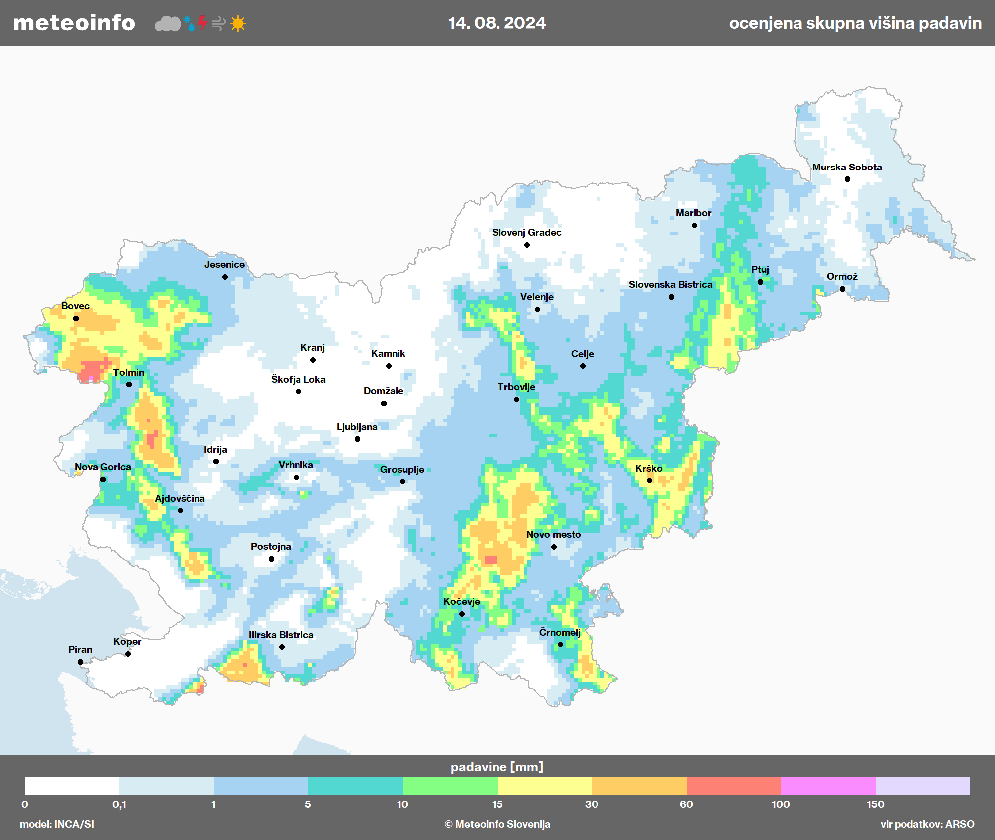
Ocenjena skupna količina padavin.

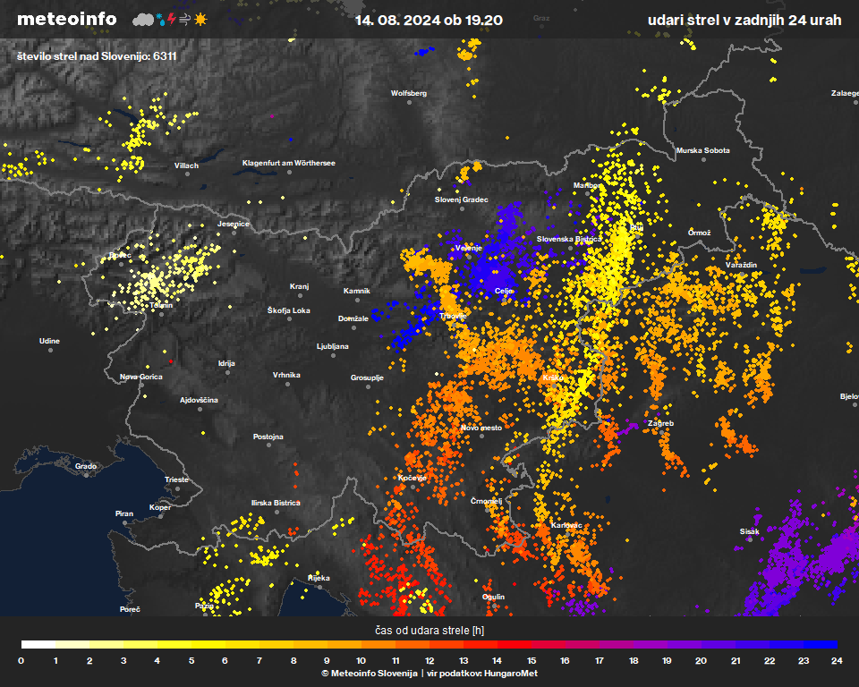
Skupno udarov strel, med 13-14. avgustom.

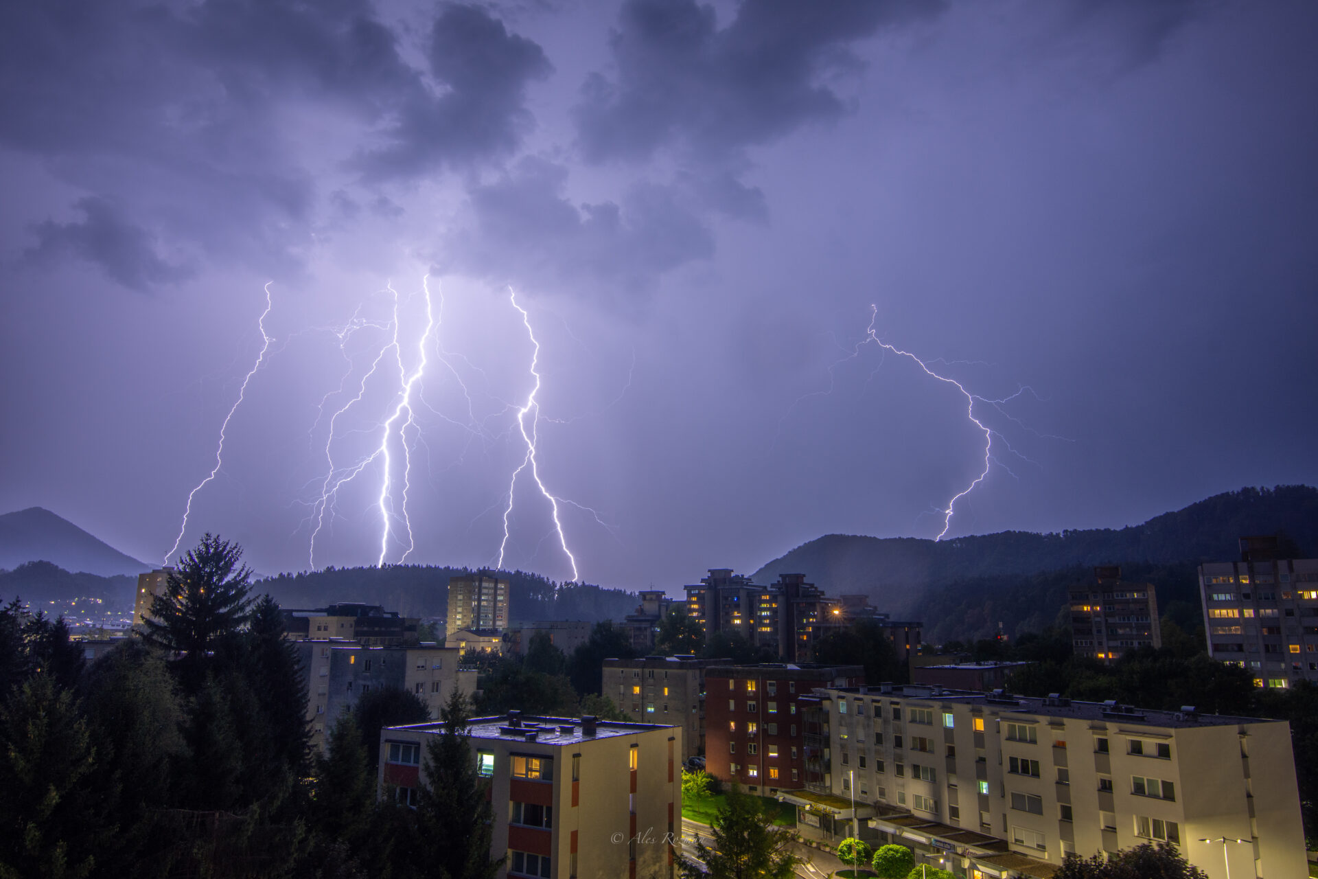
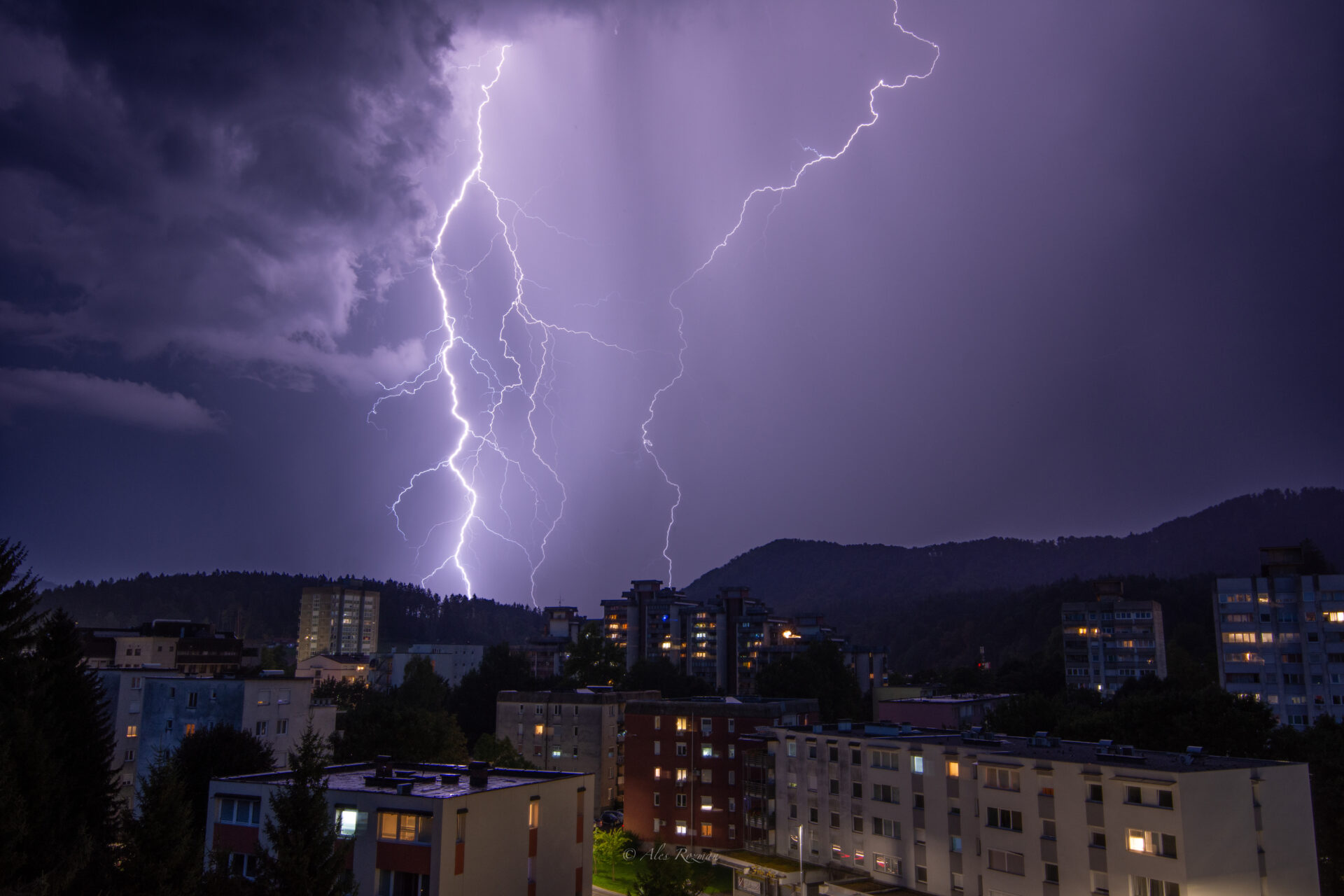
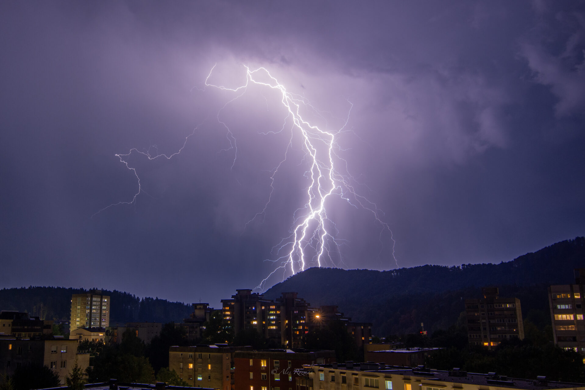
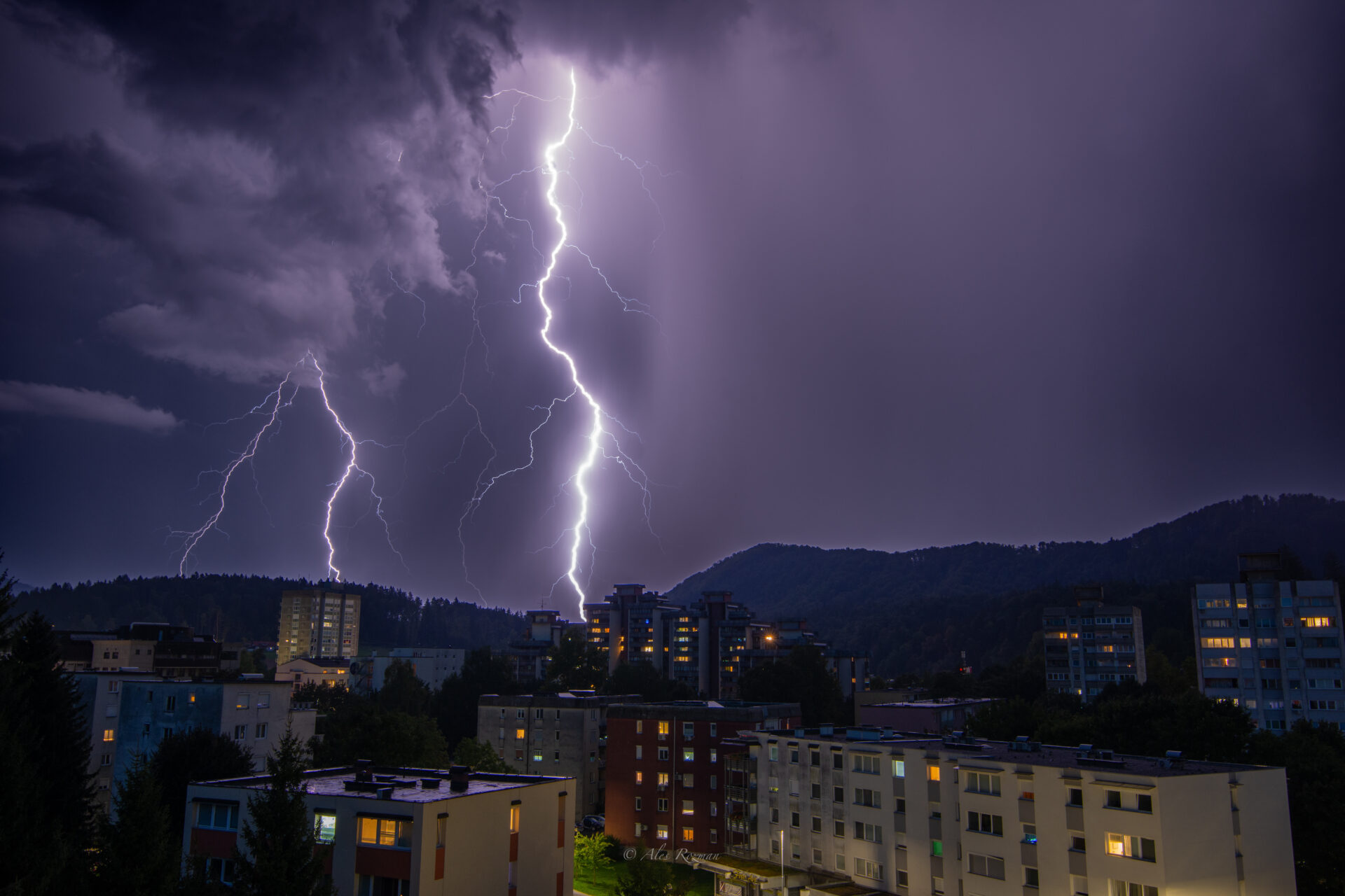
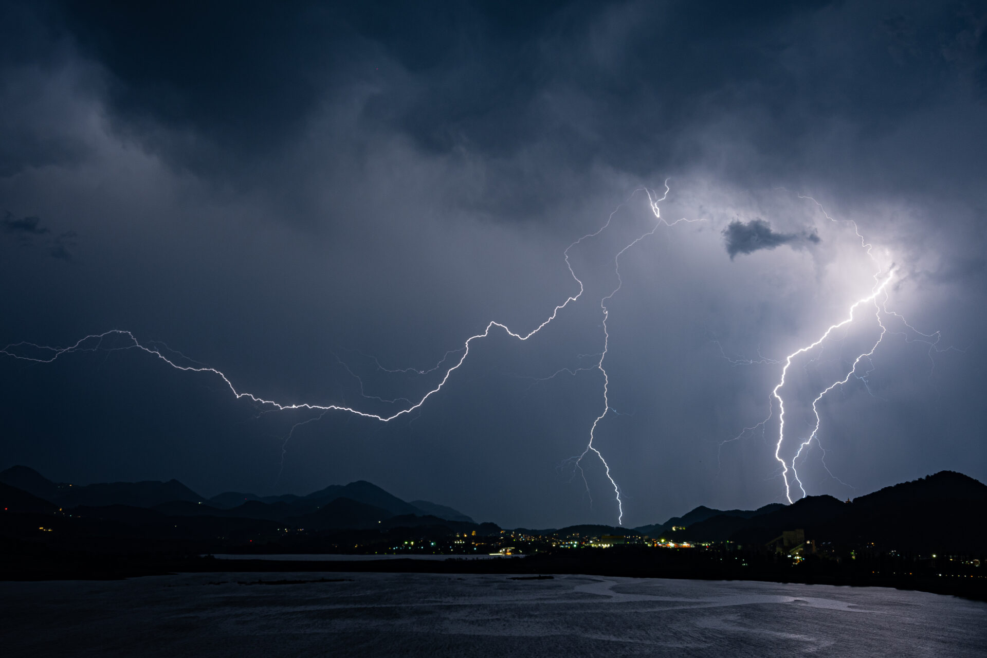
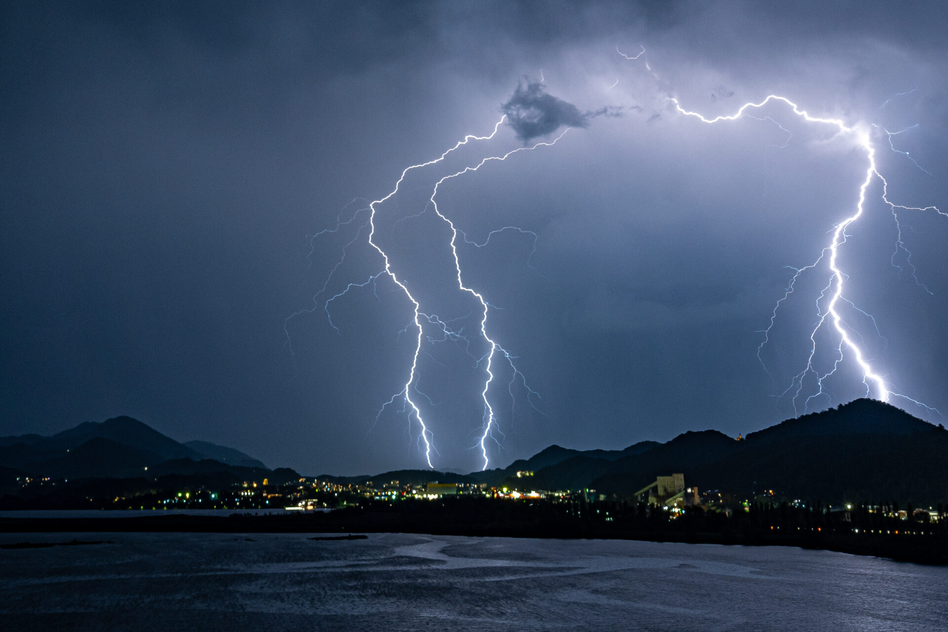
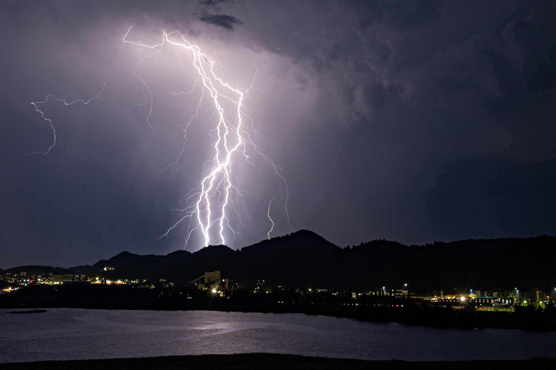
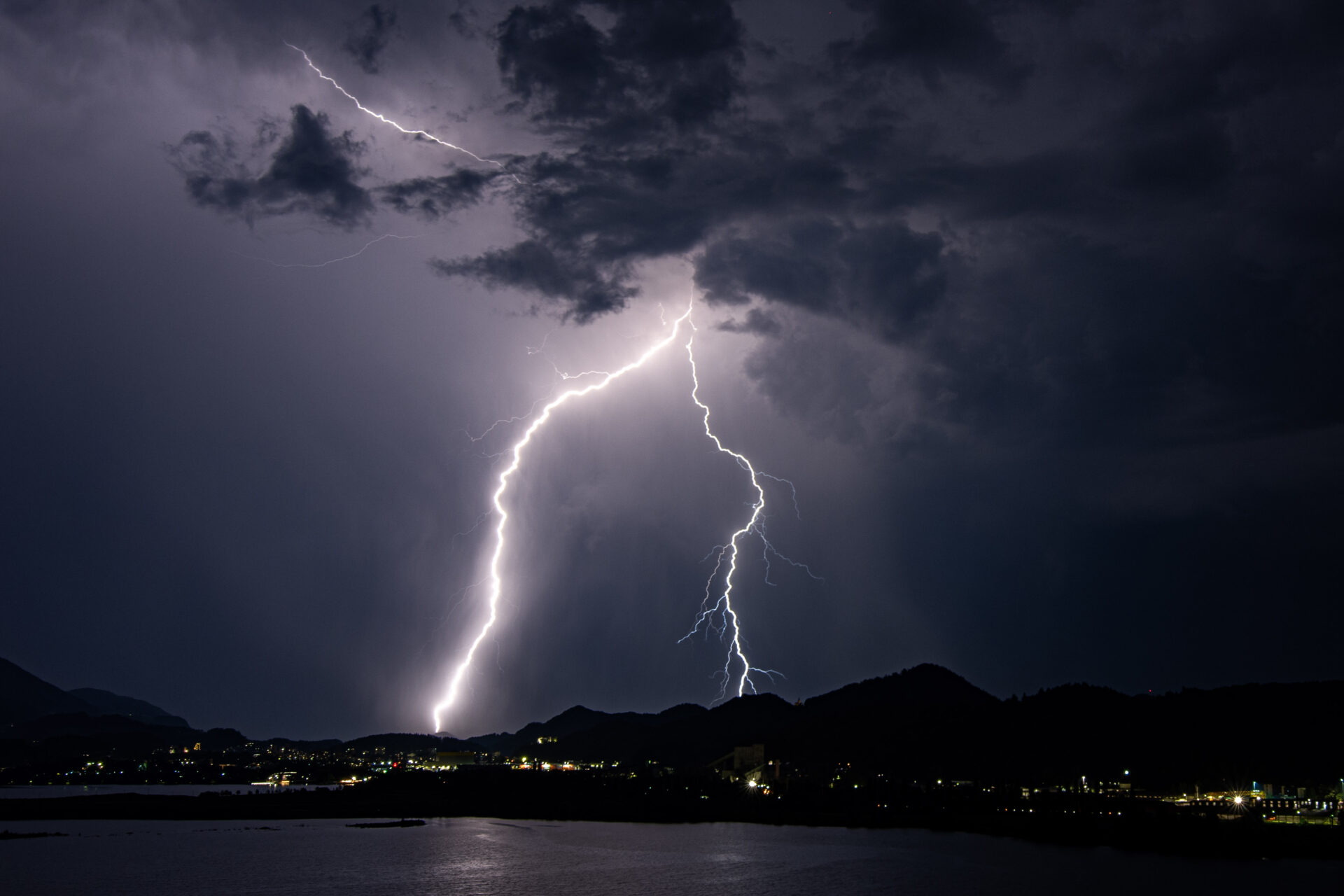
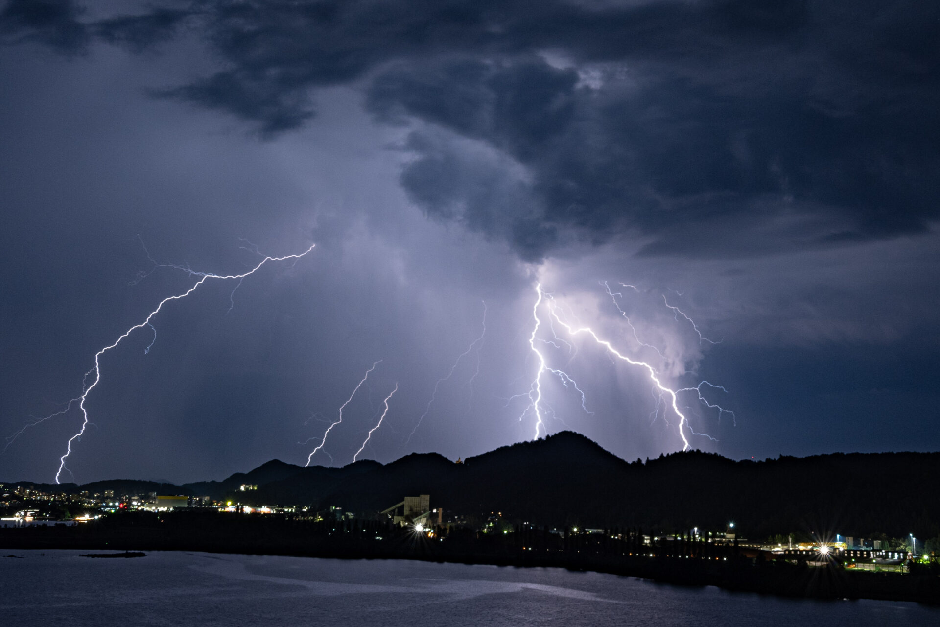
Nevihta na območju Velenja.Avtor: Aleš Rozman

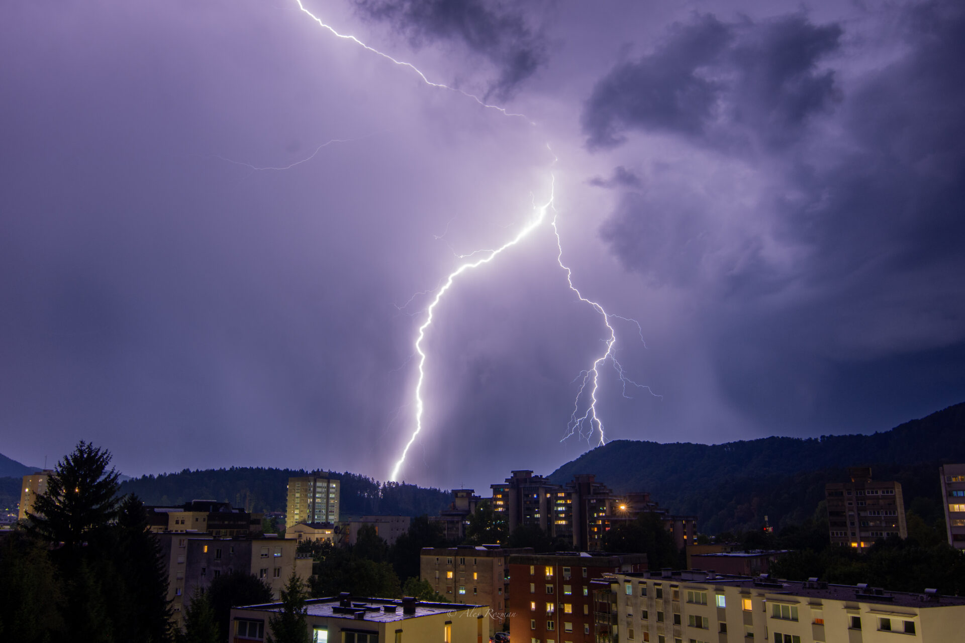
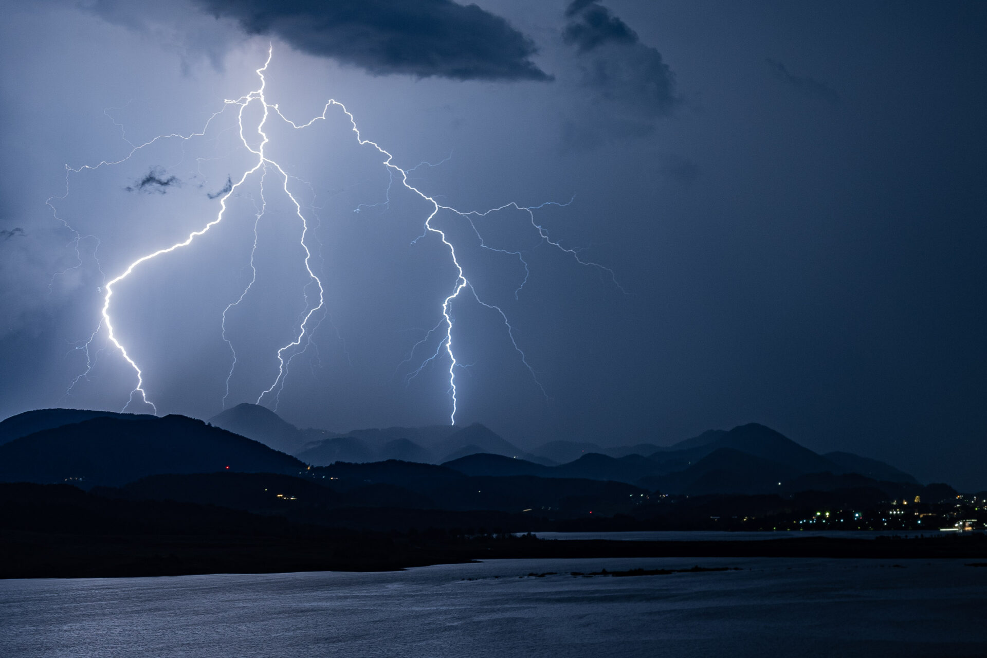
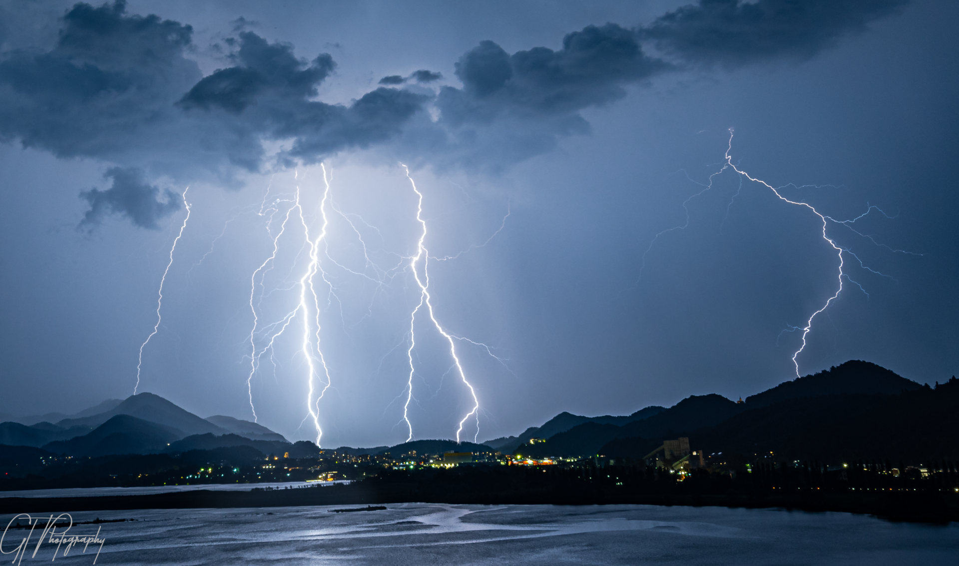
Pogled z Šoštanja na nevihto v smeri Velenja.Avtor. Tim Grešak

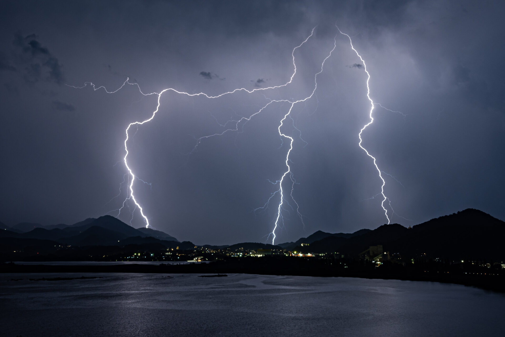
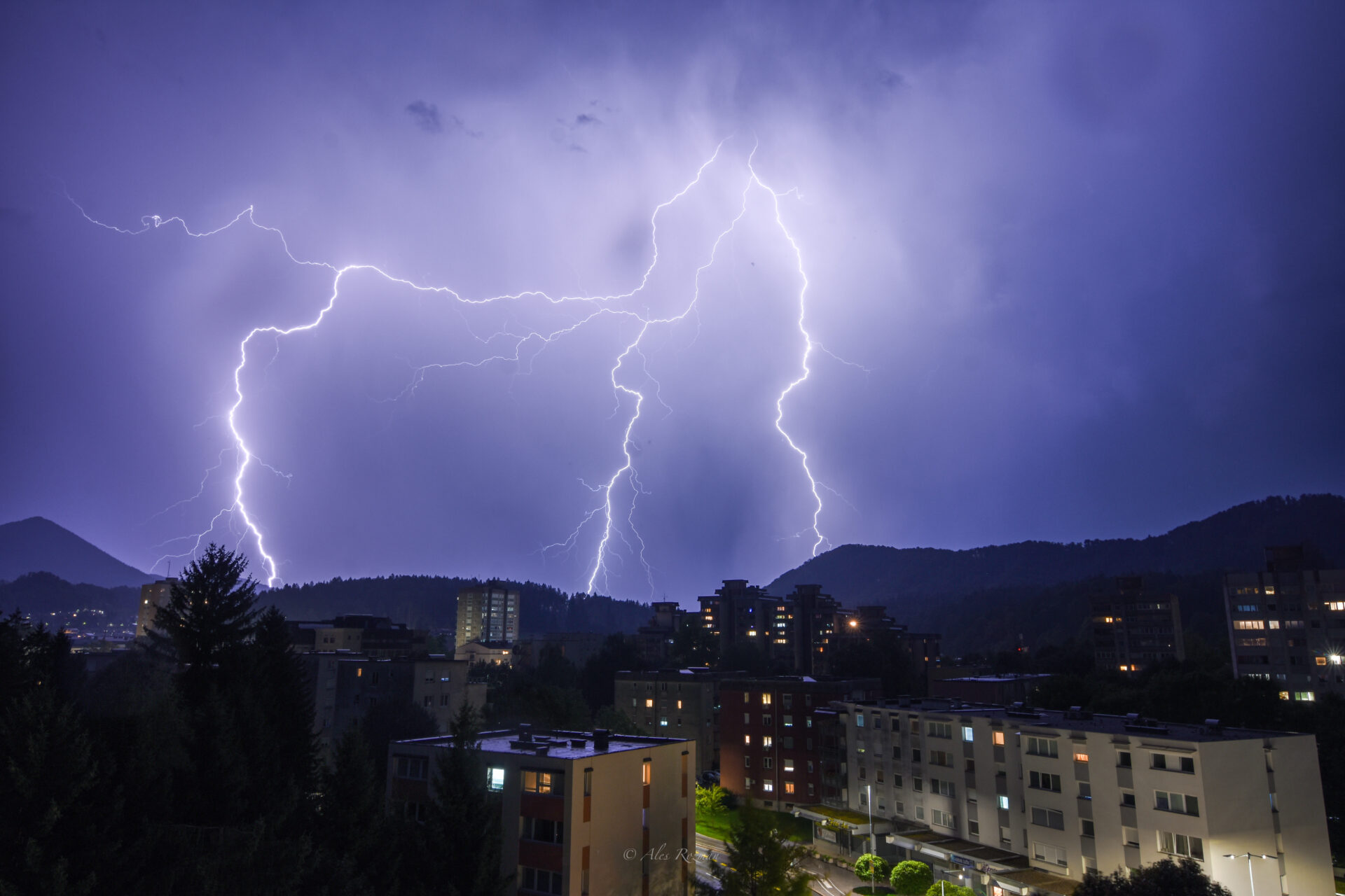
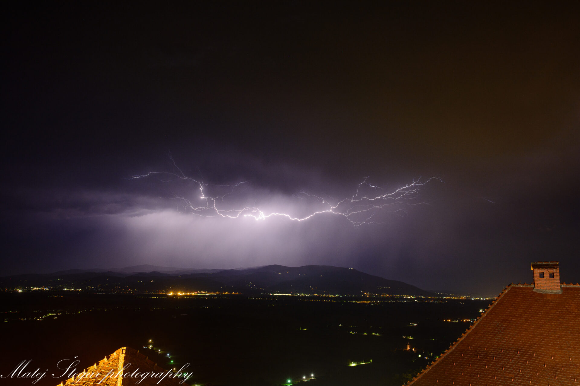
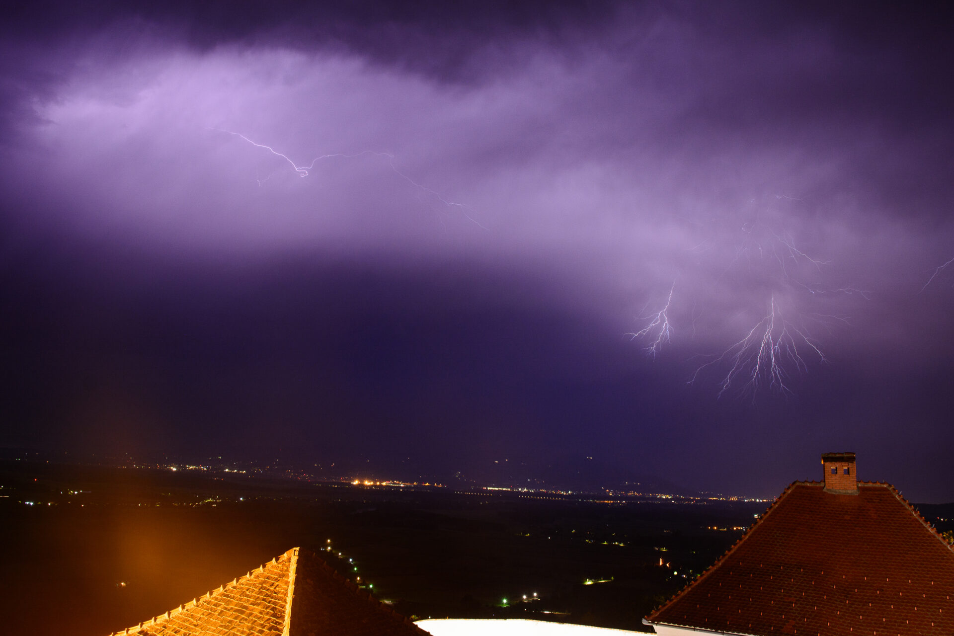
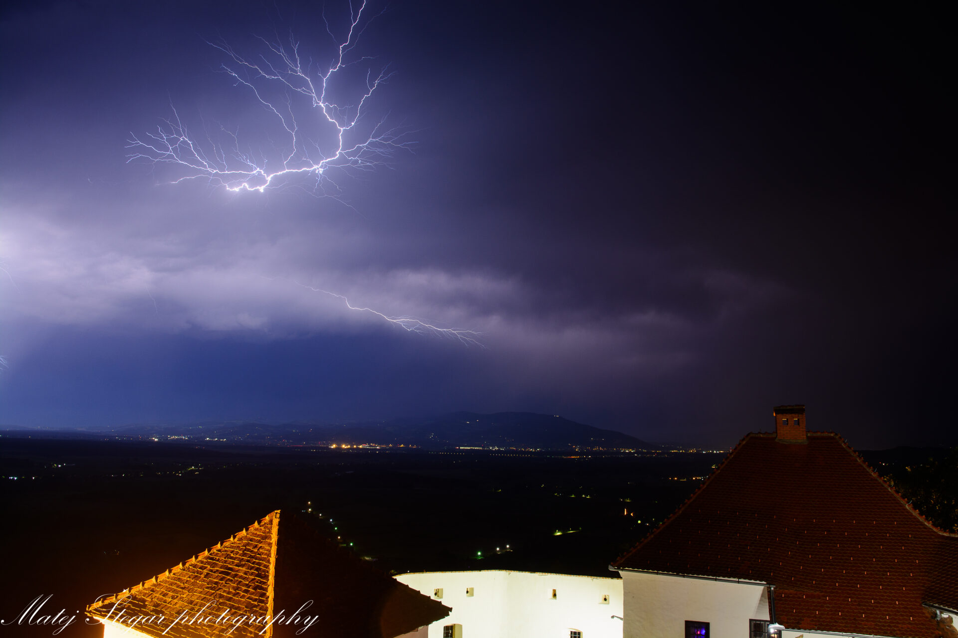
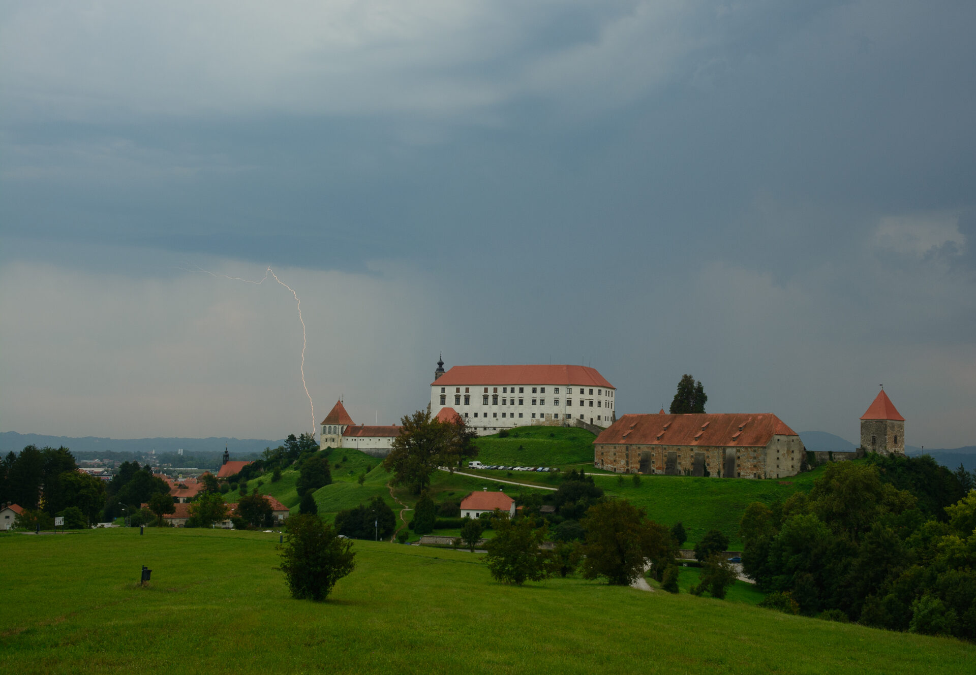
Pogled z grada Vurberg na nevihto na območju Pohorja.Avtor: Matej Štegar

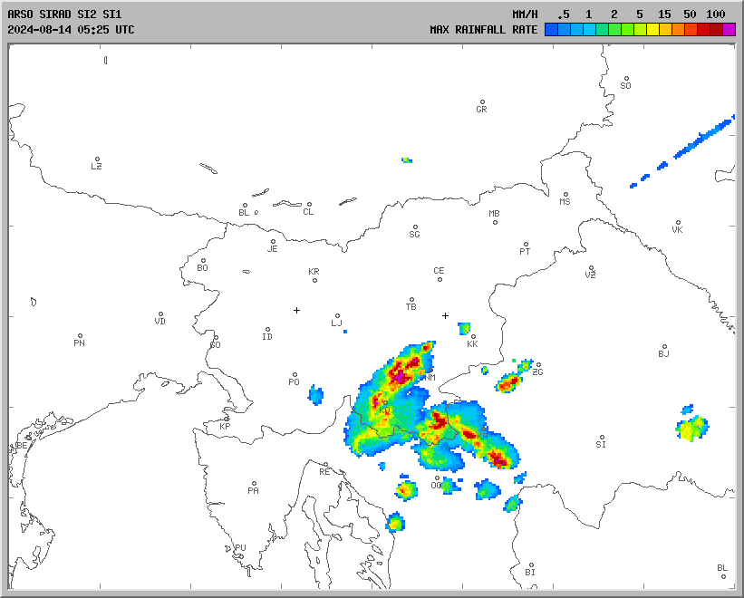
V sredo 14. avgusta so se že zjutraj in dopoldan pojavljale na jugovzhodu in severovzhodu nevihte z močnejšimi nalivi, sunki vetra in drobno točo. Popoldan pa so tudi na severnem Primorskem in Gorenjskem nastale močnejše nevihte z nalivi in točo. Na Arso postaji Krn je padlo v eni uri 54,9mm, od tega kar 46,3 mm v 30 minutah.

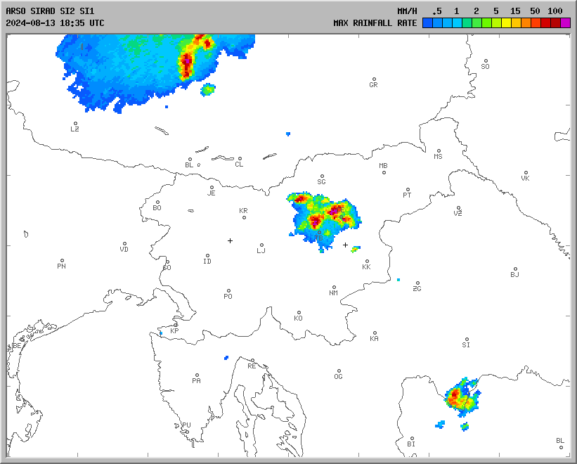
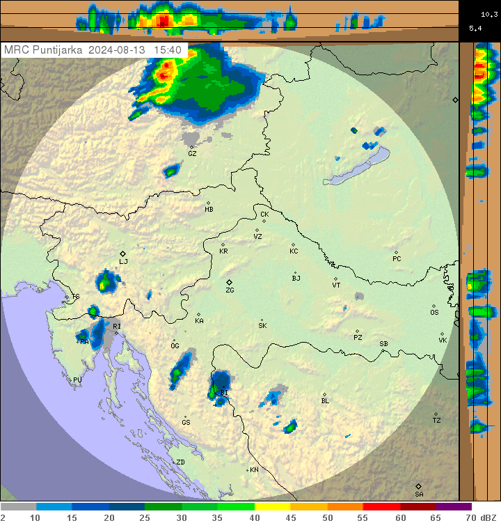
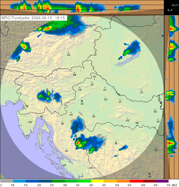
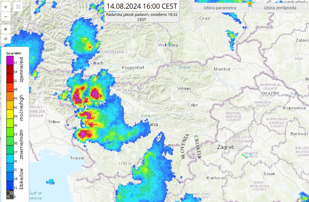
Radarska slika padavin. Vir: Arso in DHMZ

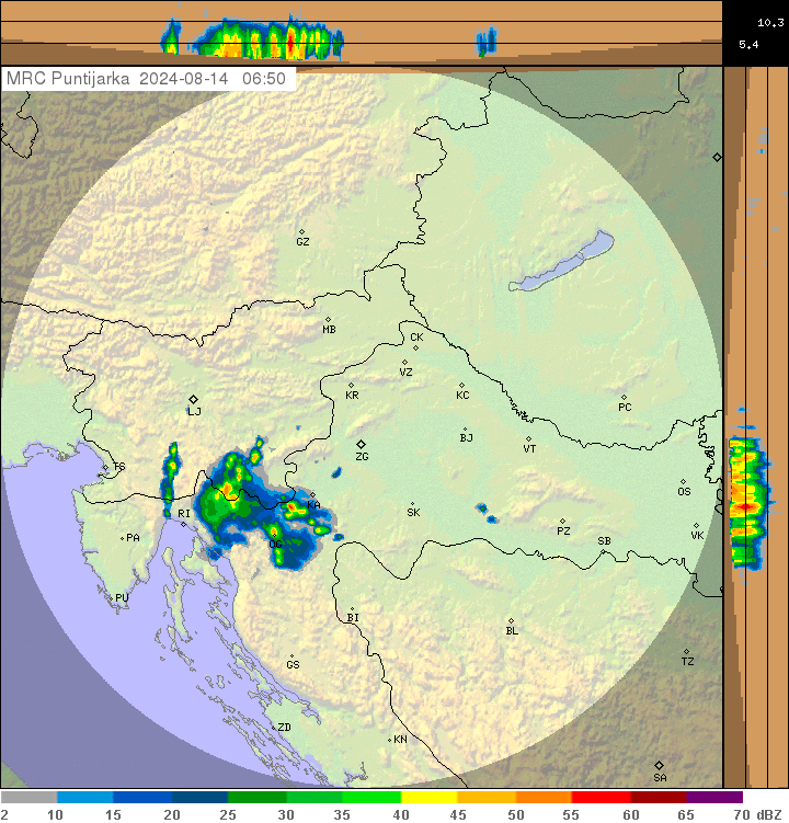
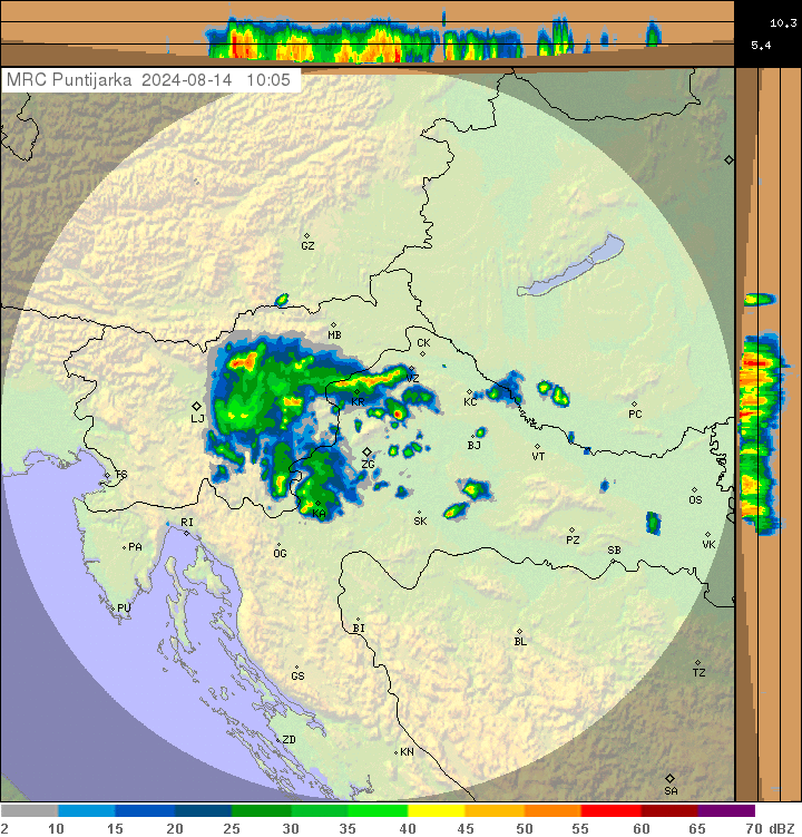
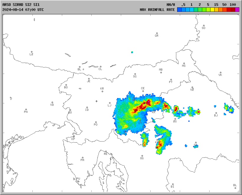
Močnejše nevihte na severnem Primorskem in Gorenjskem.

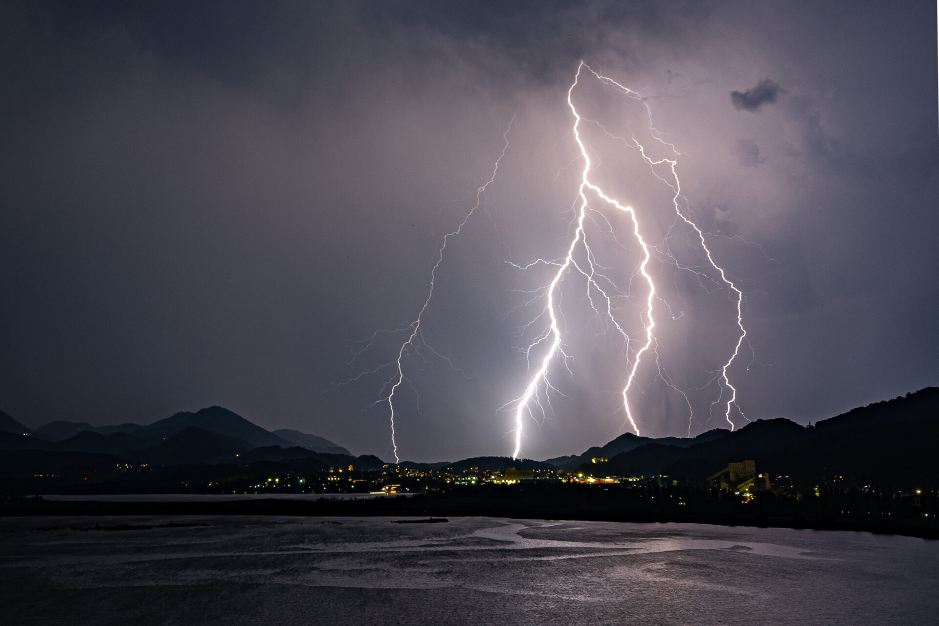
Prihod nevihte na območje Ptuja ob okrog 11 ure. Avtor: Matej Štegar

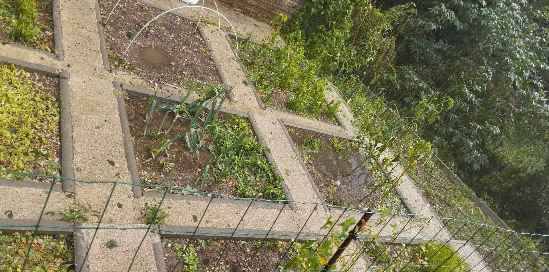
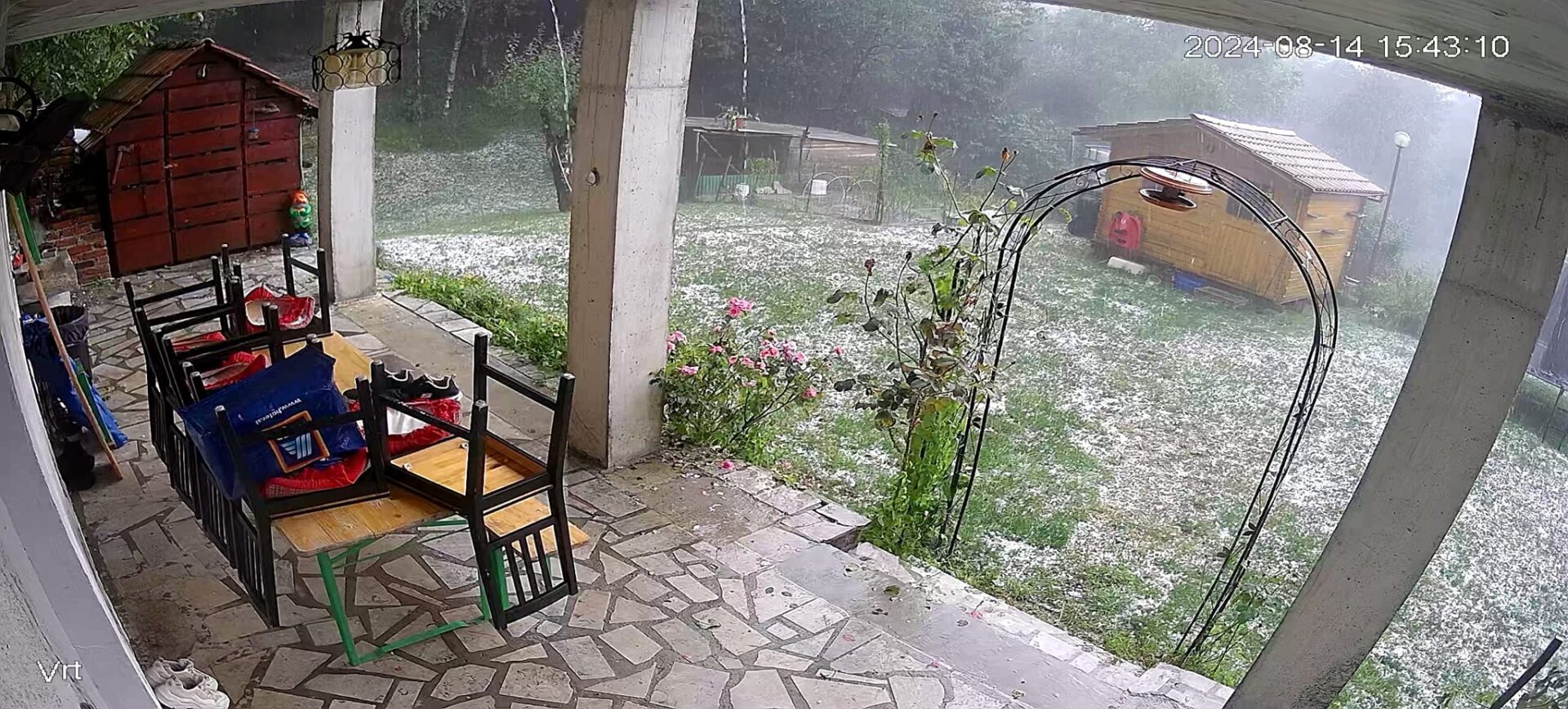
Toča v kraju Čepovan. Avtor: Martina Bratuš.

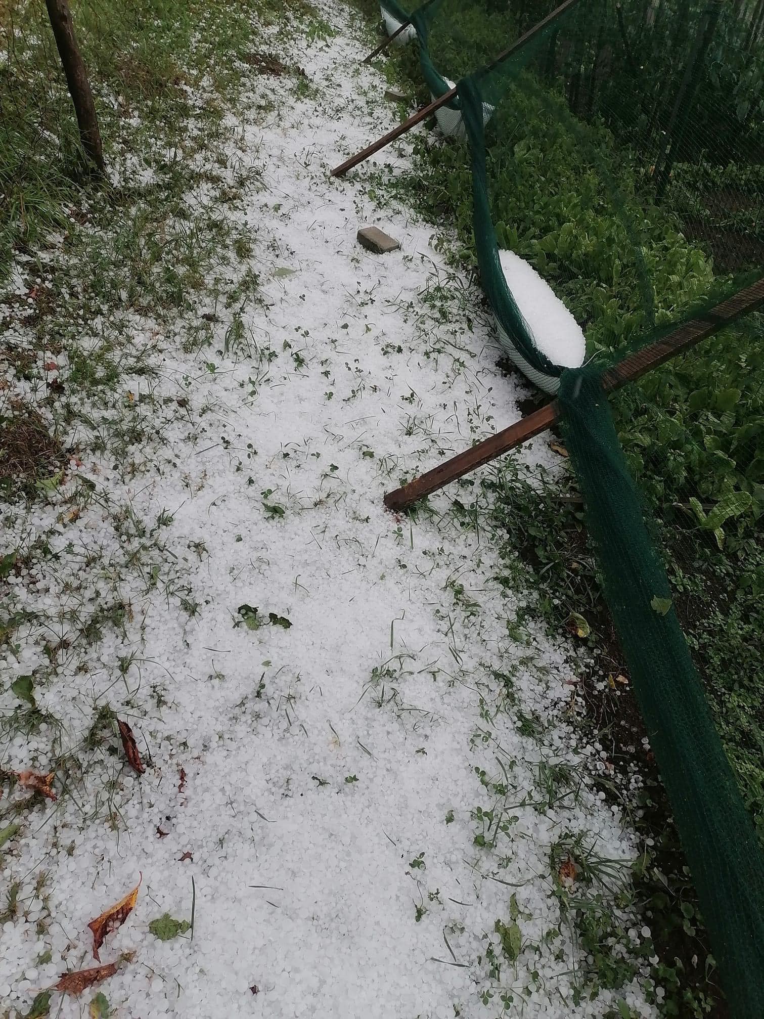
Posledice popoldanskega neurja s točo v Čepovanu pri Novi Gorici.Foto: Rok Boltar

https://www.eposavje.com/kronika/v-krskem-strela-udarila-v-smreke-veter-podrl-drevo-na-avto

Deli vsebino na:

Matej Štegar

Sem Matej Štegar, po poklicu ekonomski tehnik. Že več kot 20 let spremljam in beležim vremenske pojave. Doma imam svojo vremensko postajo, ki vsakih 5 minut pošilja aktualne podatke na splet. Spletna stran je dosegljiva na tem naslovu ptuj.zevs.si. Ukvarjam se tudi z fotografiranjem ekstremnih vremeneskih pojavov. Že 15 let lovim nevihte, v zimskem času grem tudi na meritve burje na območje Hrvaške(Kvarner), ter v Sloveniji. Do sedaj sem lovil nevihte v naslednjih državah:Slovenija,Hrvaška,Italija,Madžarska,Avstrija,Češka,Nemčija in Francija.

Radarska slika padavin

Udari strel

Spremljajte nas